


The Mid-West Deer Management Plan and associated maps and appendices are listed below.
The Plan has recently been reviewed to cover the period 2023-28, and any comments can be made to the Secretary of the Group at victor@nativewoods.co.uk
Updated Plan 2023-28
MW DMP Background Information & Policies
Habitat Monitoring plots by property
There are at present a number of significant environmental initiatives and projects being developed within the area. This page will be updated by autumn 2025 to take account of these. Between them, they represent a very significant change in management objectives for several properties.
Properties are asked to monitor the allocated minimum number of plots on a three year cycle. Maps will be added in below later in June 2024 once final data comes in.
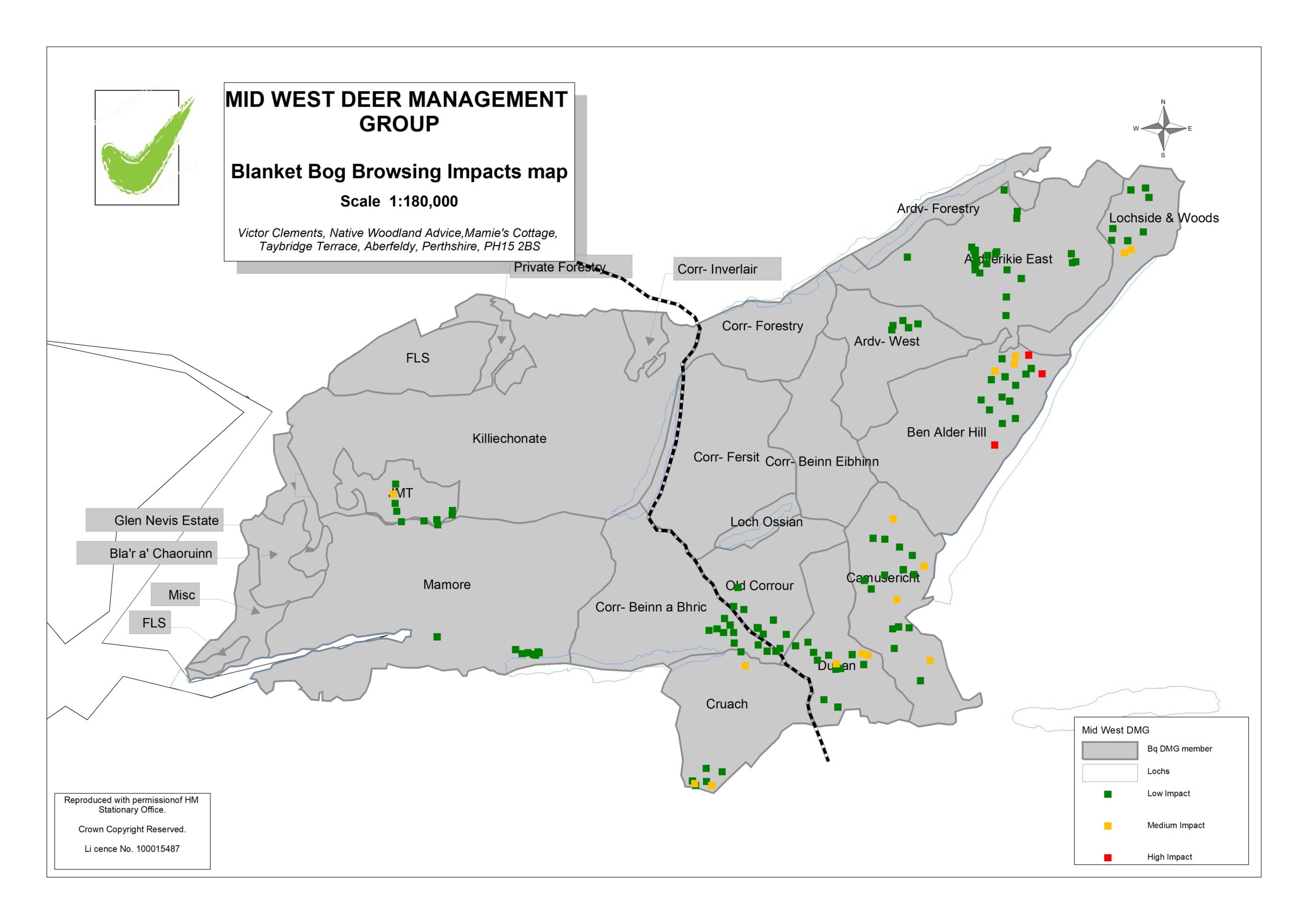
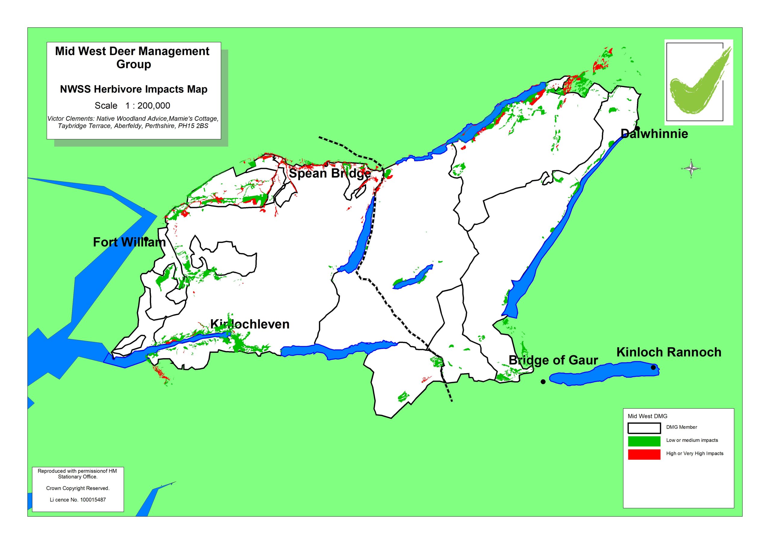
2023 Blanket bog browsing impacts
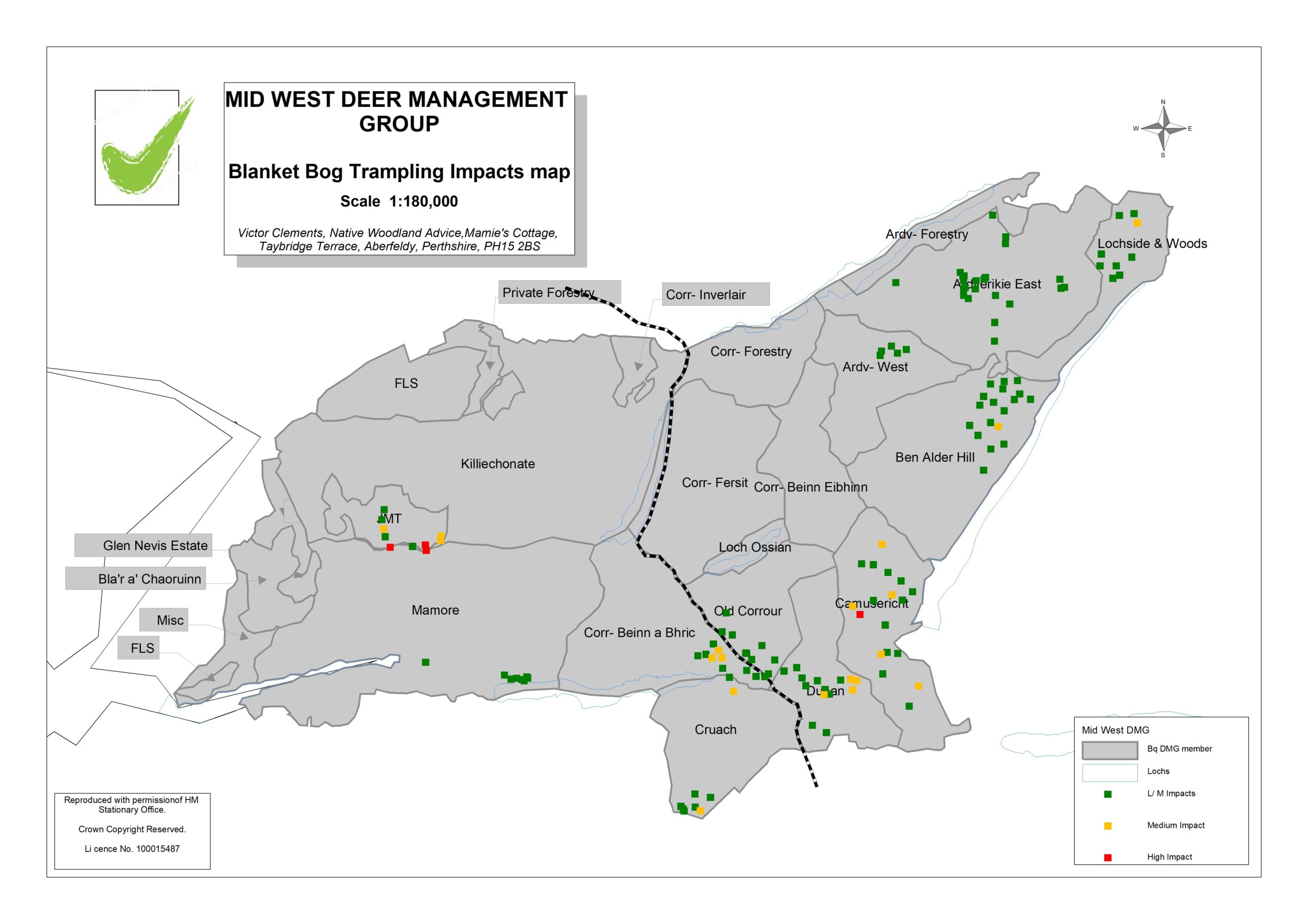
2023 Blanket bog trampling impacts
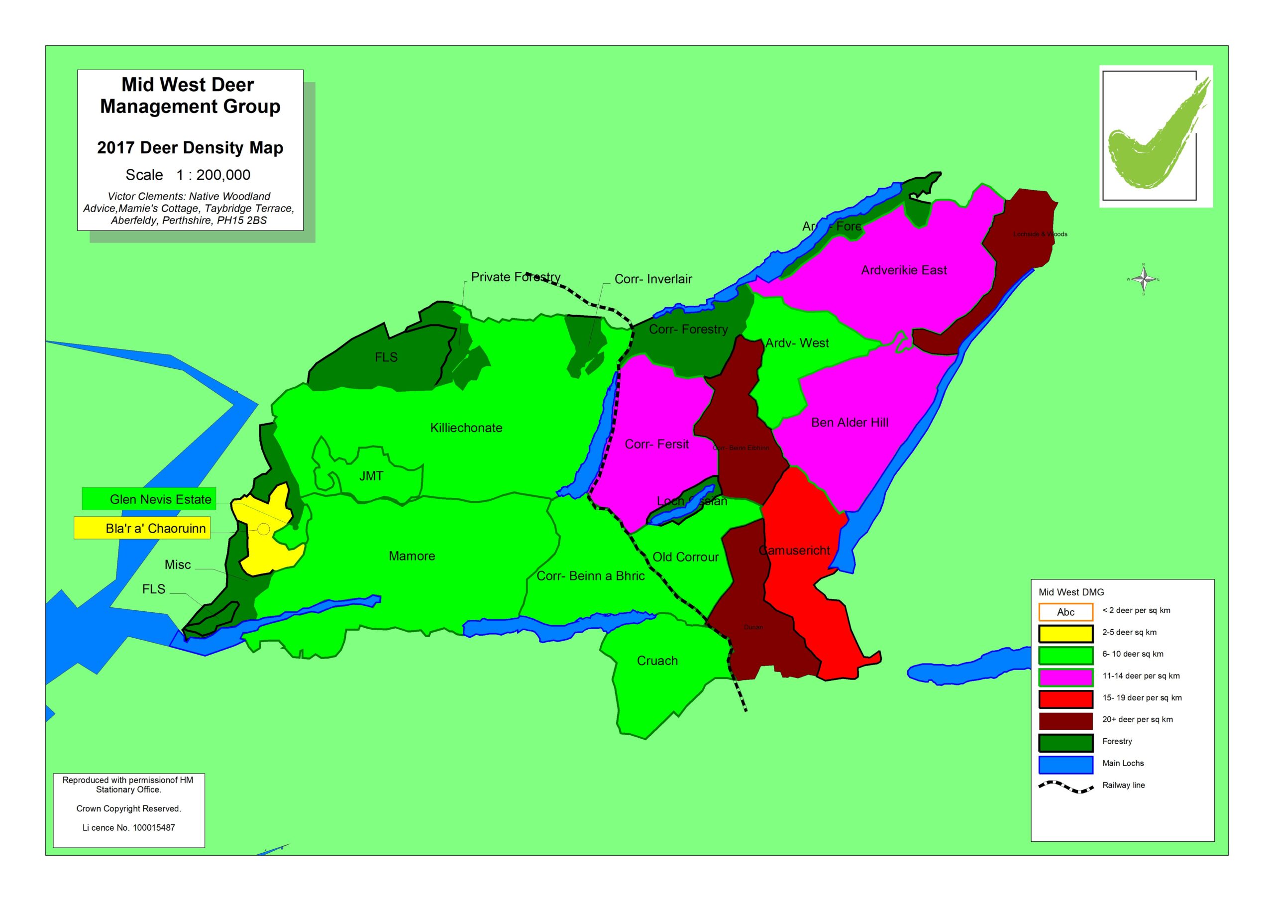
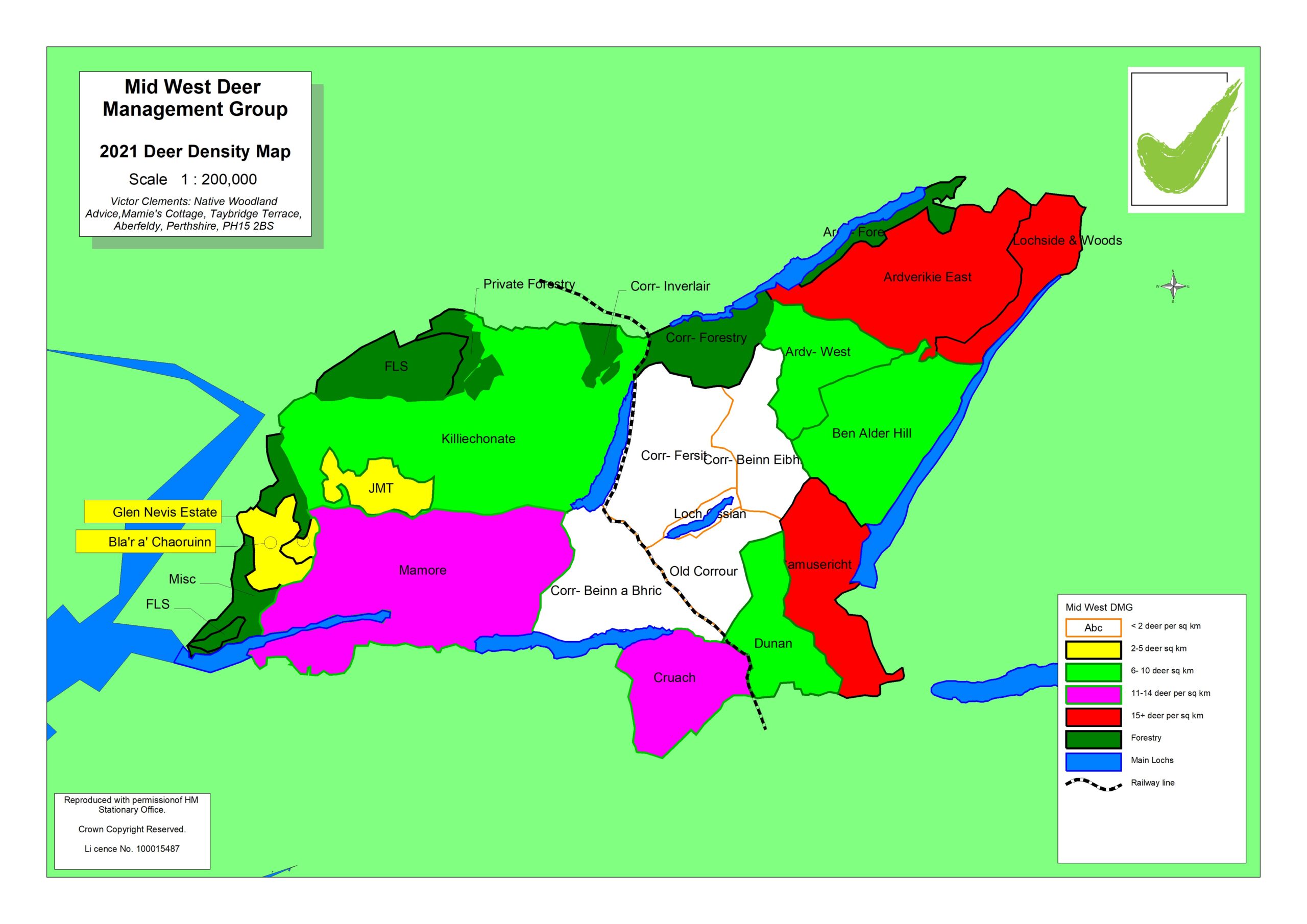
Objective for East side has been to maintain a steady population of 8 deer per sq km. This objective will now change as significant reduction cull now envisaged on Ardverikie Estate, and the updated model now includes this.
Objective for west side is to almost halve population to 5.8 per sq km within 5 years, or sooner if this is practicable. As at June 2024, culls are ahead of schedule, aided by lower recruitment in 2024. It is likely that culls will be adjusted after the 2024-25 season.
The two models above will have to be significantly changed following counts in spring 2025, and changes in management objectives. Updated models will be added to this page when they are ready, hopefully before autumn 2025.
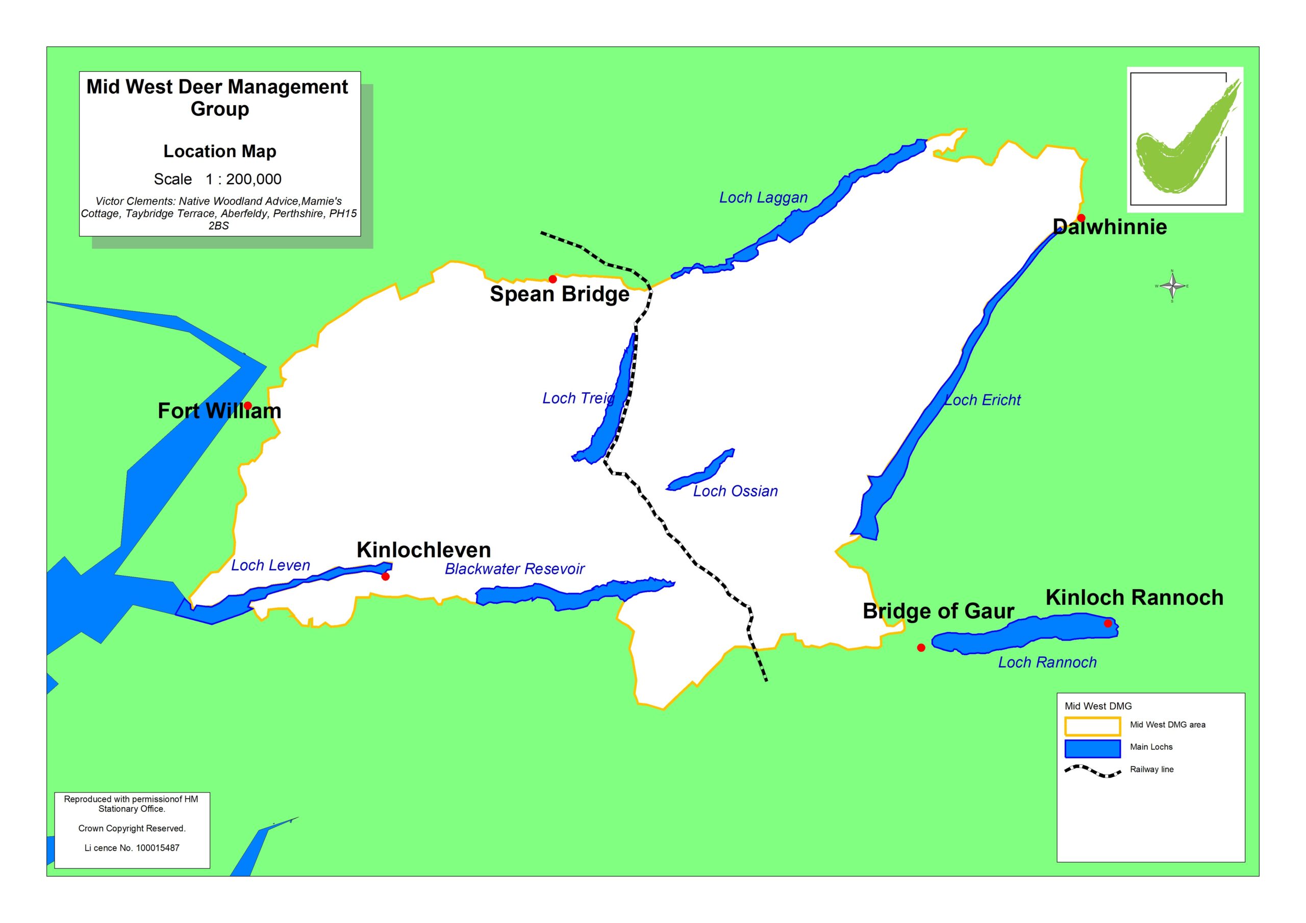
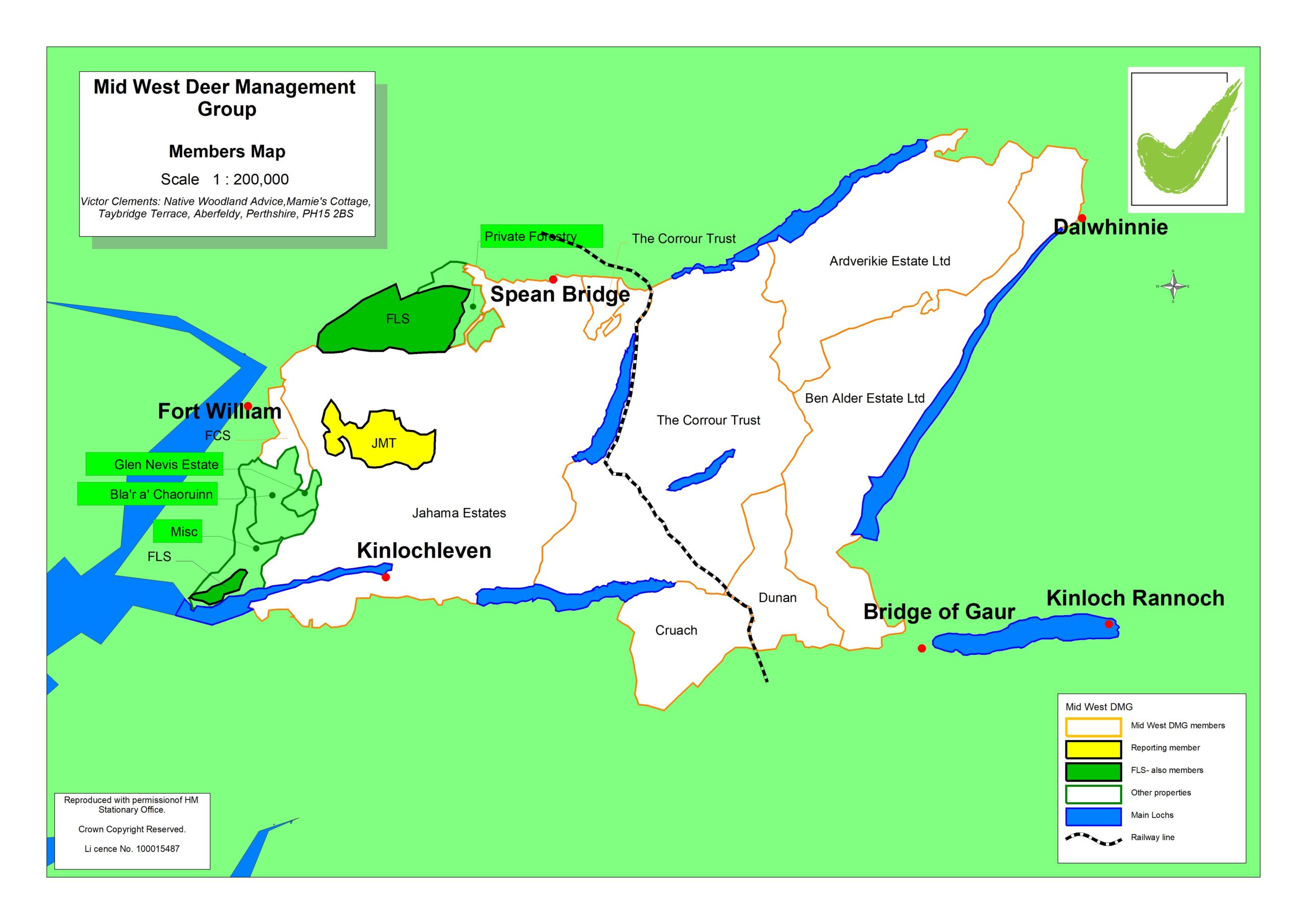
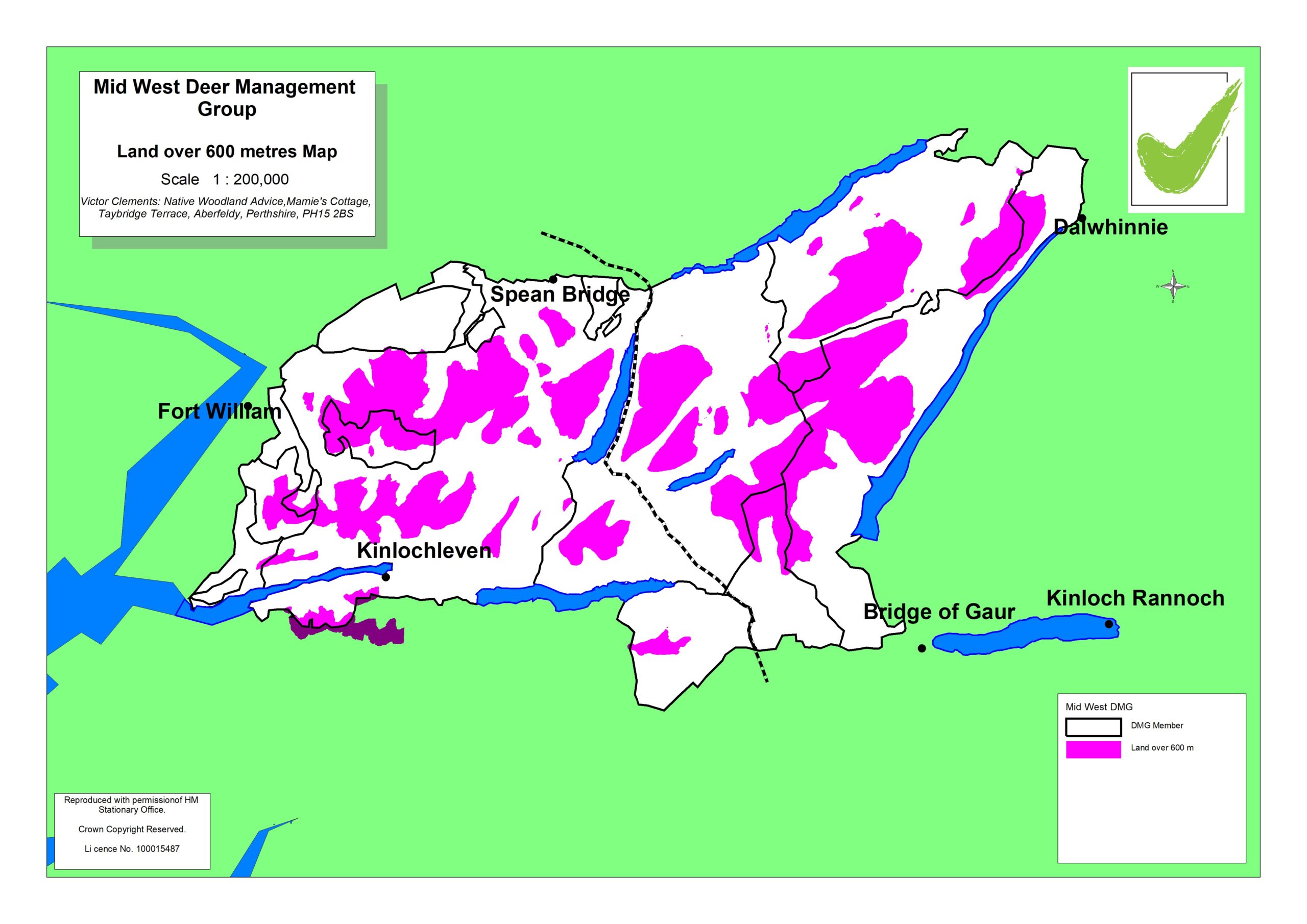
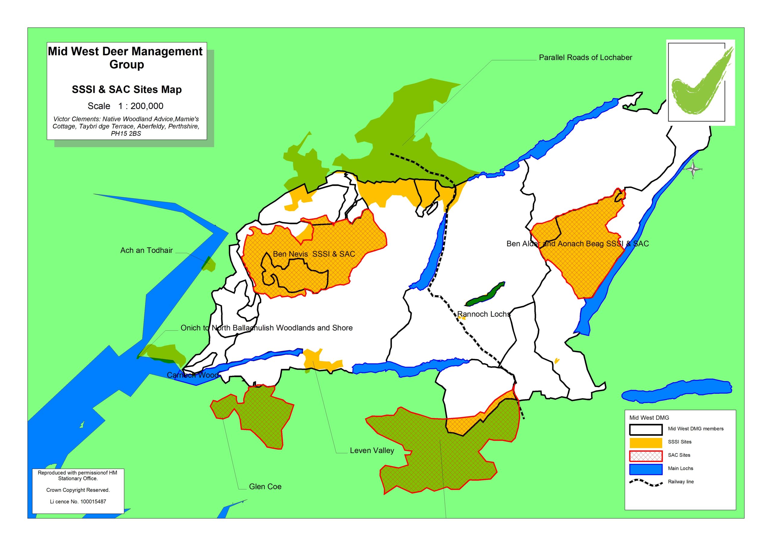
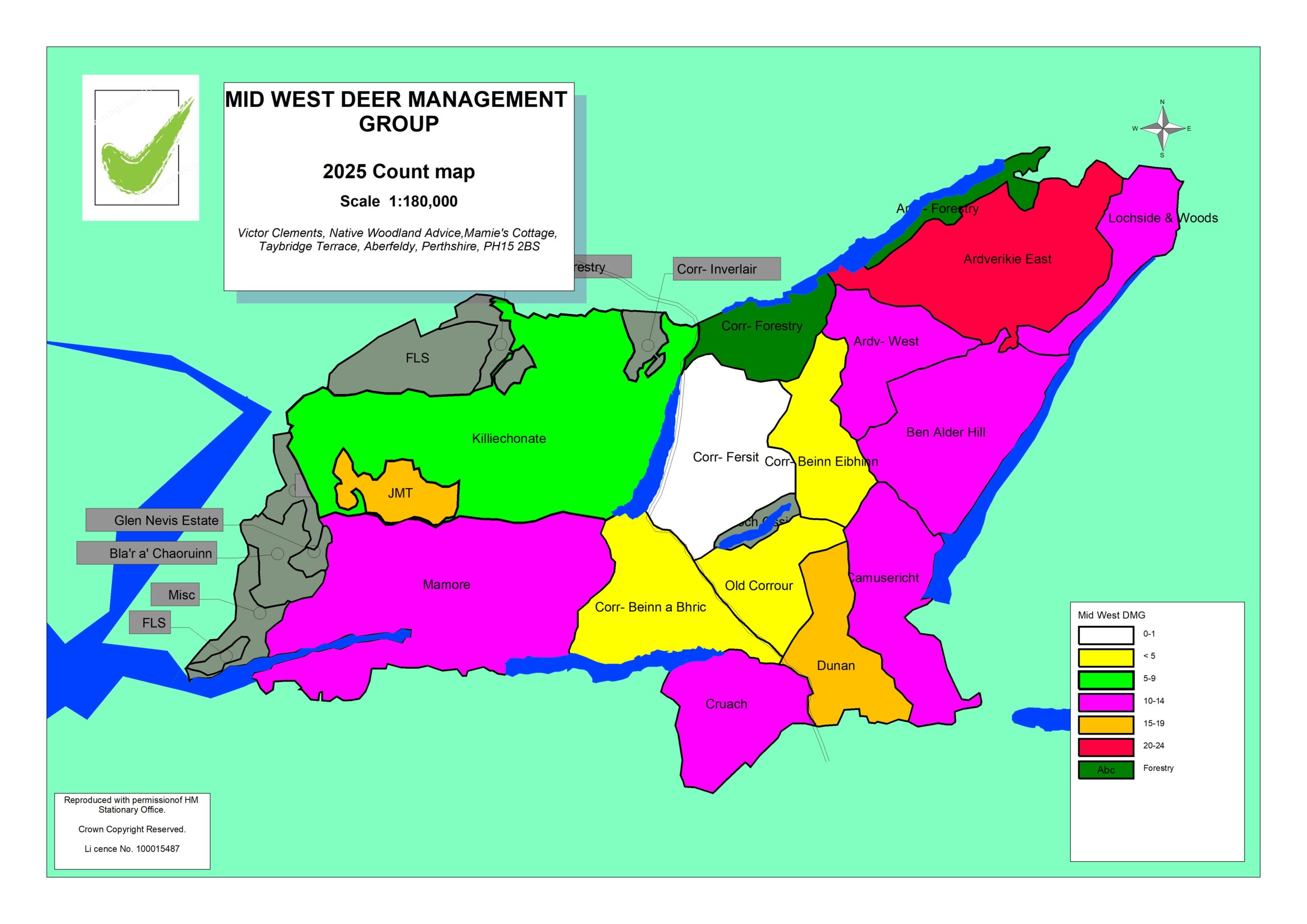
Maps
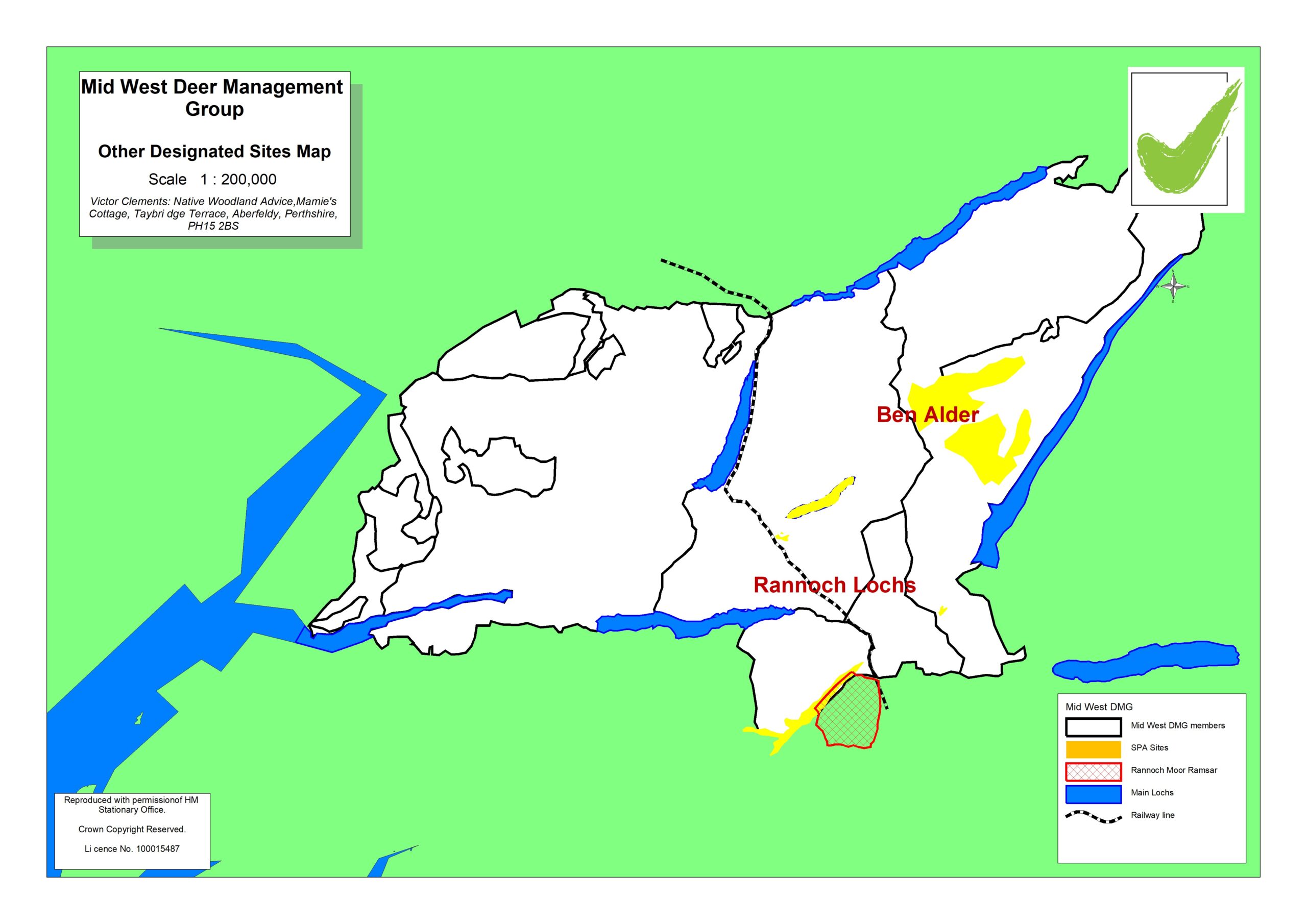
MW SSSI & SAC Designated sites map
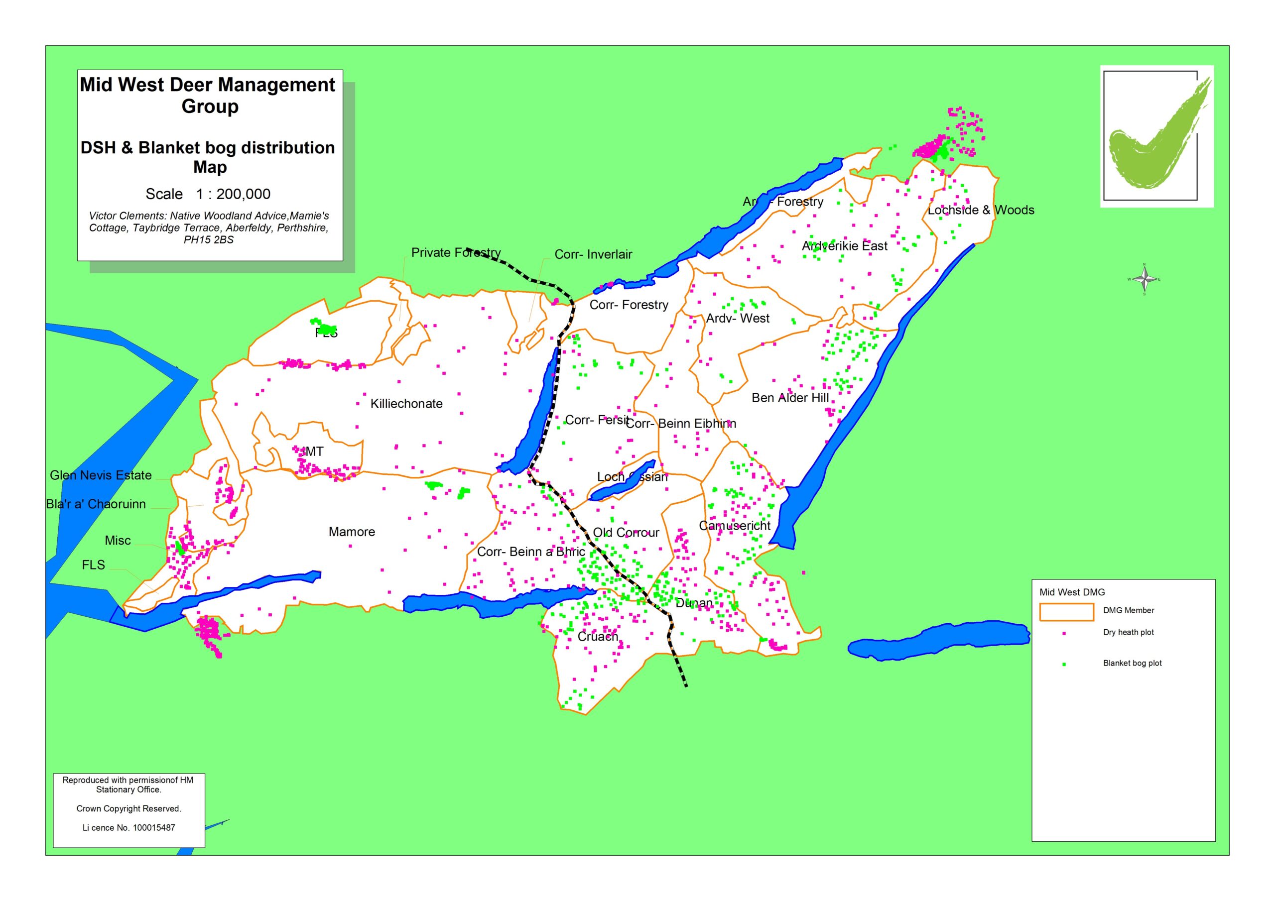
MW Distribution of dry heath and blanket bog map
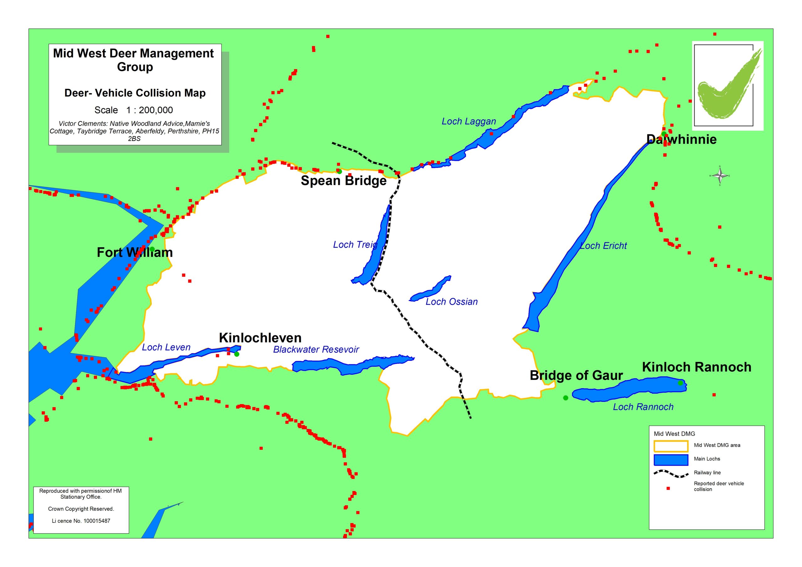
MW Deer- Vehicle collisions map
Appendices
Appendix 1 MW DMG Designated Sites Information
Appendix 2 Monitoring of Designated sites
The spreadsheet above has been amended to reflect the situation in autumn 2024.
Appendix 4 – Best Practice Habitat Assessment Guides
Appendix 5 – Carbon rich soil, deep peat & priority peatland map
Appendix 6 – National Forestry Inventory for Mid-West DMG area
Appendix 7 – Chronic Wasting Disease: Protecting Scotland’s Deer Leaflet
Appendix 8 Habitat Type summary
Appendix 10 Deer Information Required